
Overview
The Wairahi Tracks Charitable Trust (WTCT) gained approval from the Whangarei District Council (WDC) to build a shared user path from Langs Beach to Tarata Place on council land running parallel to Cove Road.
WTCT is also part of a wider community group of track developers who have come together under the umbrella of The Piroa Trails Group (PTG) whose main goal is to establish a shared user path linking Waipu in the north to Mangawhai in the south.
From Waipu Cove follow the road south and cross on to the gravel path after the one land bridge. This path follows Waipu Cove road all the way to Langs Beach. You may choose to rejoin the road as you drop down into Langs as the footpath is narrow. At the public toilets at the south end of Langs Beach turn left and head up Hector Lang
From Waipu Cove follow the road south and cross on to the gravel path after the one land bridge. This path follows Waipu Cove road all the way to Langs Beach. You may choose to rejoin the road as you drop down into Langs as the footpath is narrow. At the public toilets at the south end of Langs Beach turn left and head up Hector Lang Drive. Ride all the way to the cul de sac at the top of the hill. A short accessway at the top of the hill takes you through to Seacrest Boulevard. Turn left and then left again on to Margaret Way. From here you follow the pretty shared user path to Bream Tail Road.
Status: Priority / Planning
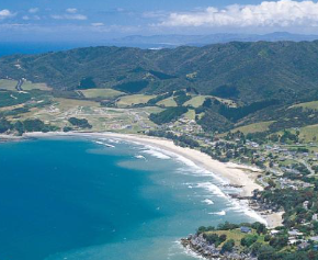
Location Map – Indicative
The map below shows the current ride using existing roads. This map is a guide only. It does not necessarily reflect the finalised route.