There are many tracks, trails, and urban walks in Northland. Rather than duplicating the information, we have included links to these sites below. There are also a number of helpful phone apps available for planning or tracking your walks. We have included links to details on a few popular walks. We will expand the list and welcome details of walks that you have enjoyed.
Some Websites and Apps for Planning, Navigating, and Recording Walks
Plan My Walk
This is a relatively new NZ website and app provided by the NZ Mountain Safety Council. If you register, you can create custom walks—this is especially useful if you are planning to combine walks. There are currently more than 200 walks in Northland that are available on Plan My Walk. You can search for a track or use the map view if you are unsure of the name.
Brought to you by Plan my Walk
Komoot
Komoot can be used for planning your walk and navigating the route or simply recording a walk. When you register, you can save your routes and recall them on the phone app and navigate the track or trail. While navigating, it will display your current location, altitude, distance covered, and the distance & estimated time left for your walk. The basic version of the app is free to use and will meet most casual hikers’ requirements.
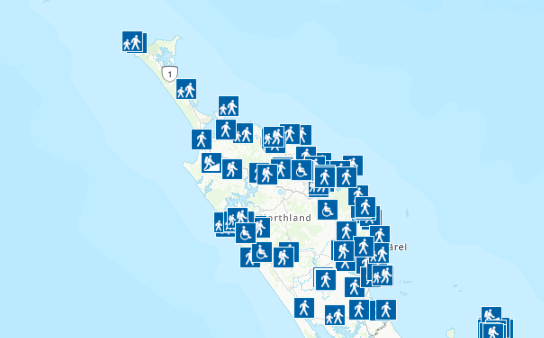
DOC Tracks and Walks
Clicking on the link below will take you to the DOC tracks page. It will open in a new window. You have the option of a map view (as shown in the image below) or searching using different filters such as difficulty, duration, and location.
Strava
Strava is ideal for recording your walks. The app is free to use if you are just using this recording feature. If you decide to use the more advanced features, then a subscription applies.
A selection of Northland Walks
Whangarei walks (Whangarei District Council website)